
Our day from Blauherd to Sunnegga perfectly blended alpine beauty, adventure, and a touch of Swiss unpredictability. We began on the Crystal Trail, hiking through shifting fog to reach Stellisee, where the clouds briefly lifted to reveal a fleeting but magical Matterhorn reflection before rolling back in. From there, we climbed to Fluhalp, a cozy alpine hut perched above the lake and admired the Matterhorn half-veiled in clouds. We then swapped hiking boots for mountain carts, racing down from Blauherd to Sunnegga in a fast, winding run that felt straight out of Mario Kart. From there, we followed the Gourmet Trail to Chez Vrony for a scenic lunch in furry recliners overlooking alpine meadows and chalets, with the Matterhorn playing hide-and-seek in the clouds. The afternoon brought light rain as we continued along the 5-Lakes Trail, passing Grindjisee, Grünsee, Moosjisee, and Leisee, where mist softened the turquoise waters and wildflowers shimmered with raindrops. We ended the day with kickbikes from Sunnegga to Zermatt, gliding through forest trails toward the valley. Even with the drizzle, it was a day of lakes, laughter, and unforgettable alpine charm.
🗓️ Itinerary
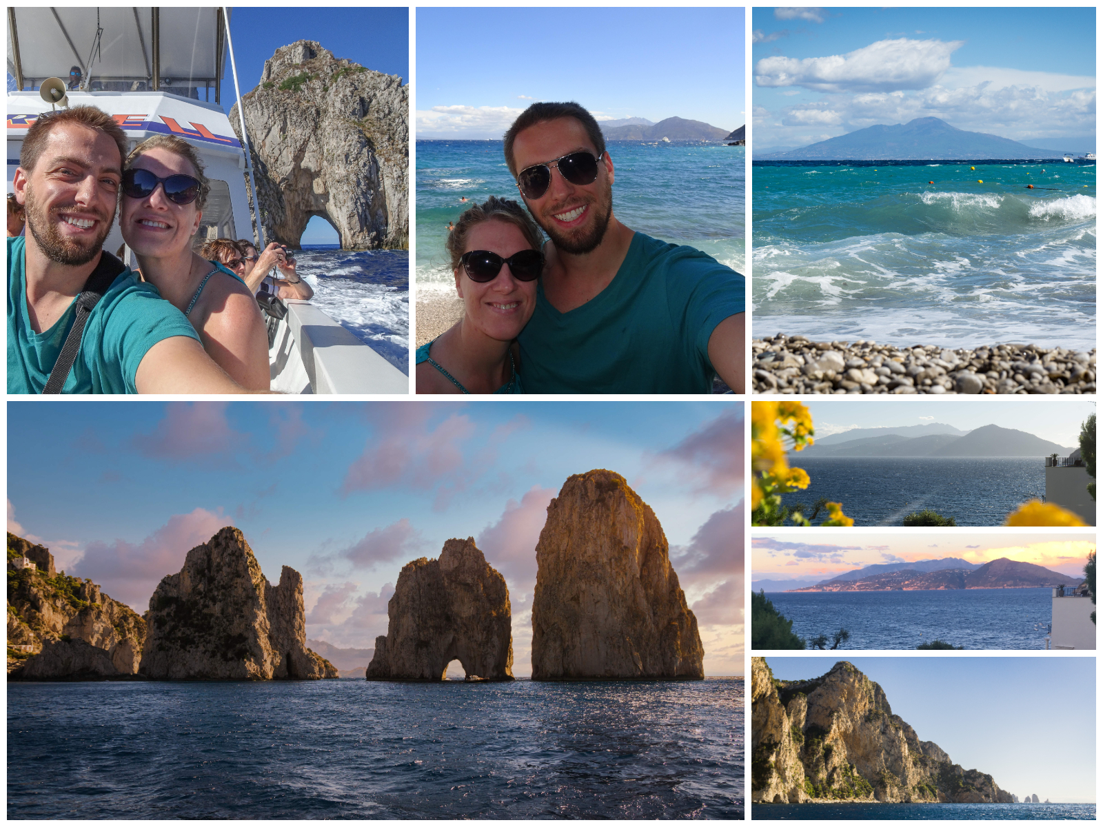
This plan came from our August 29, 2025 visit (Day 10), based in Zermatt.
💎 Crystal Trail
- 🚠 7:50 AM – Ascent: Zermatt → Blauherd (17m, 💡 EarthTrekkers itinerary tips)
- 🚶 8:50 AM – Walk (4m) to the Zermatt Bergbahnen funicular station
- 🚠 9:00 AM – Funicular: Zermatt (Talstation Sunnegga) → Sunnegga (5m, every 5m from 8 AM – 5:30 PM)
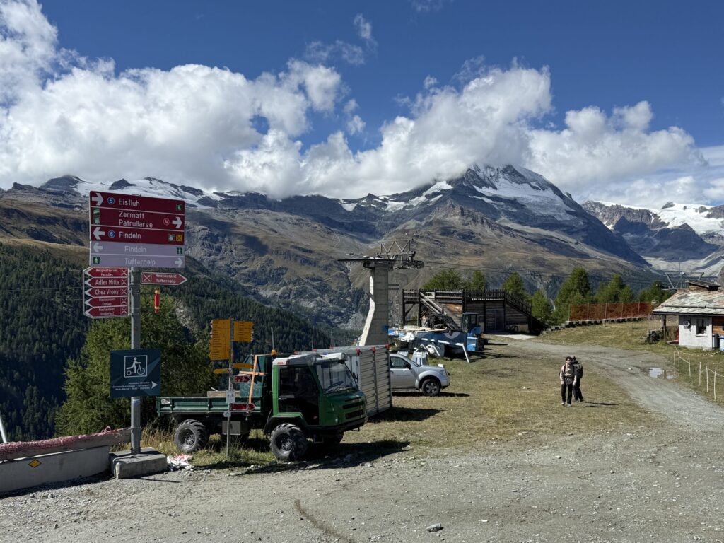
- 🚠 9:06 AM – Gondola: Sunnegga (Talstation Blauherd) → Blauherd (7m, every 1m from 8:10 AM – 4:45 PM)
- 🥾 9:15 AM – Hike part of Crystal Trail from Blauherd (~1.5-2h, 3 mi)
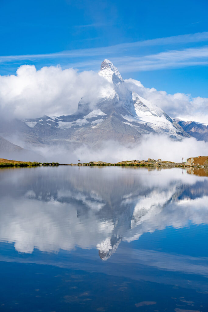
- Blauherd → Stellisee (~20m, 0.7 mi) for iconic Matterhorn reflection.
- Continue upwards along trail toward Rothorn to Mountain View at Fluhalp (~30m, 0.8 mi)
- Hike back to Blauherd via Stellisee (~45m, 1.5 mi)
🛷 Mountain Carts
- ☕️ Optional: Drink and rest at Blue Lounge (⏰ time permitting)
- 🛷 11:00 AM – Ride mountain carts: Blauherd → Sunnegga (10m, rentals start at 10 AM, 🎟️ Prepaid CHF 15 each but likely not necessary because there were no lines)
🧀 Gourmet Trail
- 🥾 11:30 PM – Hike along Gourmet Trail: Sunnegga → Chez Vrony (15-30m, 0.8 mi, scenic downhill)
- 🍽️ 12:00 PM – Lunch @ Chez Vrony (🎟️ RESERVE terrace, CHF 50 / person fee for no show, can cancel by 6 PM night before, 2h limit)
- ⭐️ Popular Michelin star restaurant with iconic mountain-chalet terrace with Matterhorn view in furry, recliner seats
- Restaurant Hop / Backups: Findlerhof, Adler Hitta, or Enzian
🌊 5-Lakes Trail
- 🥾 1:45 PM – Continue via 5-Seenweg (5-Lakes Trail) skipping Stellisee to avoid backtracking (2.5h, 4.6 mi, Komoot route)
- 🥾 Hike: Chez Vrony → Findeln (~10m, 0.3 mi uphill) – dirt/gravel multi-use trail
- 🌊 Hike: Findeln → Grindjisee (~50m, 1.3 mi steep ascent with lake views and dirt path descent) – forest-lined green lake with wildflowers and peaceful scenery
- 🌊 Hike: Grindjisee Lake → Grünsee (~30m, 1.0 mi mostly uphill with open views) – rocky shore, mountain reflections
- 🌊 Hike: Grünsee Lake → Moosjisee (~30m, 1.2 mi downhill) – turquoise glacial lake, hydroelectric dam views
- 🌊 Hike: Moosjisee Lake → Leisee (~30m, 0.6 mi steep ascent)
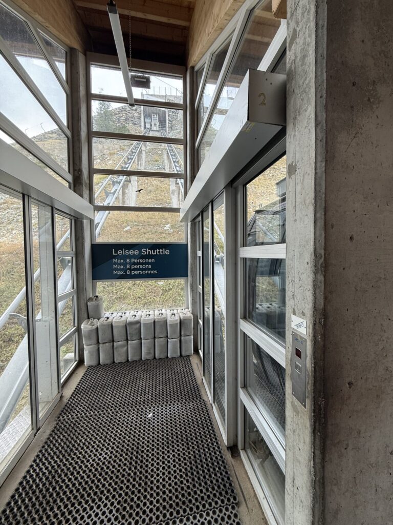
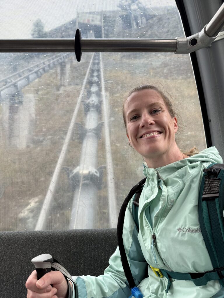
- 🛗 Free lift: Leisee → Sunnegga
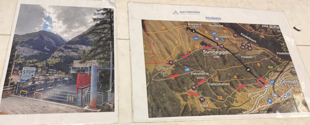
🚴♂️ Kickbike
- 🚴♂️ 4:30 PM – Kickbike: Sunnegga → Zermatt (~30m, 4.5 mi, 🎟️ Reservations not required as there are rarely lines. ⏰ Be sure to arrive before the last rental time as we barely made the 4:30 PM cutoff to enable a 5:30 PM return,💡Muddy and cold in rain and best to opt for funicular if weather is iffy. Mostly a forested path with limited views and one long flat section that required quite a bit of kicking.)
- 🚠 Backup – Funicular: Sunnegga → Zermatt (Talstation Sunnegga) (5m, every 5m from 8 AM – 6 PM)
- 🥾 Backup – Hike: Sunnegga → Zermatt (1h, 2.8 mi scenic forest trail, 650m descent)
- 🛌 5:00 PM – Return to Hotel Parnass and chill
- 🧺 Pick up picnic lunch for Aug 30 (Coop grocery)
- 🍽️ 8:45 PM – Dinner @ Schäferstube (🎟️ RESERVE, Cozy alpine chalet with quirky lamb decor and many lamb offerings)
💡 Tips
- 🌦️ Weather: Check MeteoSwiss app and Zermatt.ch webcams early (Sunnegga and Matterhorn) to confirm clear views before committing to Stellisee.
- 🧥 Pack layers and rain gear: It’s often cooler at Blauherd and windy near Fluhalp. There was also no rain in the forecast, but rained almost all afternoon during our 5-Lakes Trail hike.
- 🥾 Bring hiking poles: The 5-Lakes Trail has some steep ascents/descents with a mix of gravel and dirt.
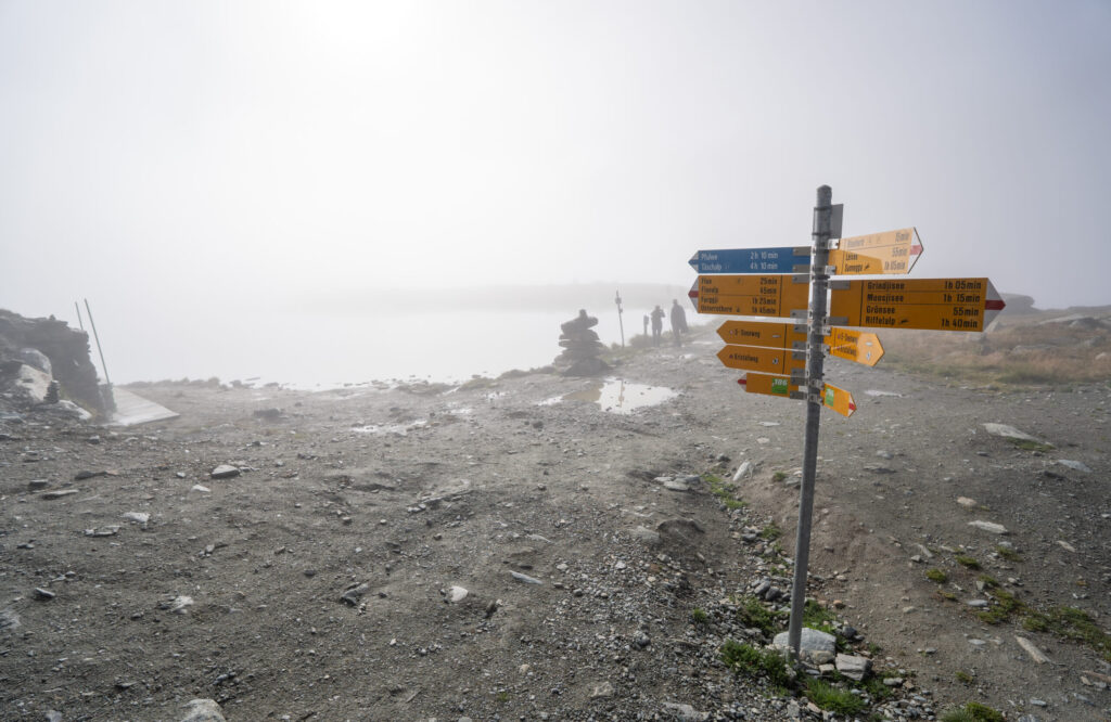
- 🚠 Check transit schedules: Verify your routes on the SBB app before heading out. We couldn’t find the Rothorn route on the SBB app and then confirmed the Rothorn cable car was closed when we tried to purchase tickets onsite. We had to adjust our plan to hike directly from Blauherd to Stellisee, which delayed our start. See our Original Rothorn Plan below.
- ⏰ Start early to beat the crowds and catch Stellisee’s mirror-like reflection before wind and haze set in. The best Matterhorn reflection usually appears between 8:30-10:00 AM when light hits the east face. On our visit, clouds dominated but luckily cleared for about 15 minutes during this window – just enough for that perfect shot before the peak vanished again for the day.
- 🪞 Prioritize Stellisee: If you’re short on time, visit only Stellisee – it’s the most iconic of the five lakes, with unbeatable Matterhorn reflections and panoramic views. The other four lakes each have their own charm – Grindjisee’s forested calm, Grünsee’s rugged terrain, Moosjisee’s turquoise glow, and Leisee’s family-friendly vibe – but their scenery is less dramatic, especially on rainy or cloudy days when reflections and peaks vanish into mist. The trail itself is mostly gravel and not particularly exciting, so unless you’re eager to check off all five lakes, focusing on Stellisee offers the best experience for your effort.
- 🧀 Gourmet Trail: Make lunch reservations on the terrace at popular restaurants – like Chez Vrony – to secure a spot with optimal views.
- 🛗 Free Leisee elevator: At the end of the 5-Lakes Hike, take the lift back up to Sunnegga – it saves a steep climb.
- 🚴♂️ Kickbikes: On wet days, the forest path becomes muddy, visibility is limited, and it is not as enjoyable, so the funicular is the safer, faster option back to town.
- 🧺 Coop groceries: Purchase picnic supplies for the next day before store closes at 7 PM. Pick up Swiss chocolate and wine to enjoy on your hotel balcony.
📸 Summary
🫶 Ascent to Blauherd
Getting to Blauherd is half the fun, thanks to a scenic, multi-stage lift journey that climbs high above Zermatt. The trip begins with the Sunnegga funicular, a quick underground ride that whisks you up through the mountain in just five minutes. From there, you transfer to a gondola to Blauherd, gliding over alpine meadows and wooden chalets as the Matterhorn gradually comes into view. It’s an effortless ascent that delivers instant alpine immersion – and a preview of the stunning trails ahead. At Blauherd, be sure to get a picture at the Matterhorn heart.


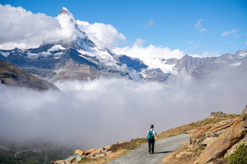
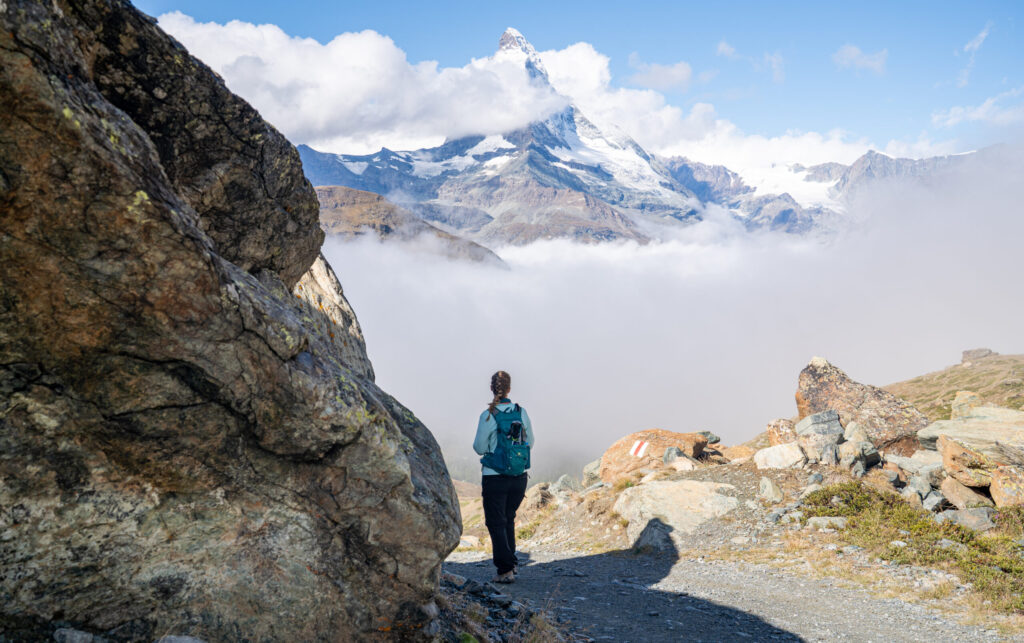
💎 Crystal Trail: Blauherd → Stellisee and Fluhalp
Starting from Blauherd, the Crystal Trail is a short but striking alpine route known for its shimmering quartz and mineral displays tucked into rocky outcrops. The path winds gently through flower-strewn meadows with panoramic views of the Matterhorn before reaching Stellisee, one of Switzerland’s most photographed lakes. We arrived during the ideal morning light and caught a brief but stunning reflection before clouds began to move in. Continuing uphill toward Fluhalp, the scenery opened to sweeping ridgelines – a classic Swiss postcard moment that made the climb well worth it.
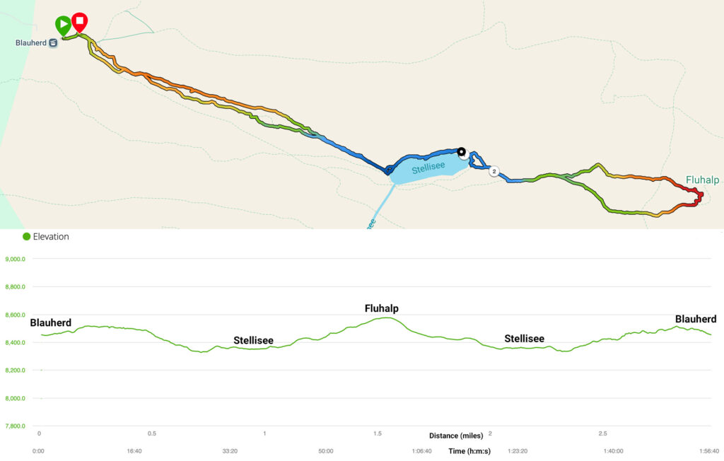
📈 Hiking Stats
Time: 1:05 moving, 1:57 elapsed to allow photo stops
Distance: 3.0 miles (4.8 km)
Max Elevation: 8,576 ft
Cumulative Ascent: 490 ft
Cumulative Descent: 461 ft
Difficulty: Easy
Directions: From the Blauherd station, follow the signs for Kristallweg (Crystal Trail) toward Stellisee. There are several paths from Blauherd, and we took the quicker, lower gravel trail on the way to Stellisee (~20m, 0.7 mi). You can loop around the lake or continue uphill toward Fluhalp for a snack and views (~20m, 0.5 mi). Then return to Blauherd along either side of Stellisee and via the upper trail to end at the Matterhorn heart photo op.
Additional Resources: Garmin Data, AllTrails
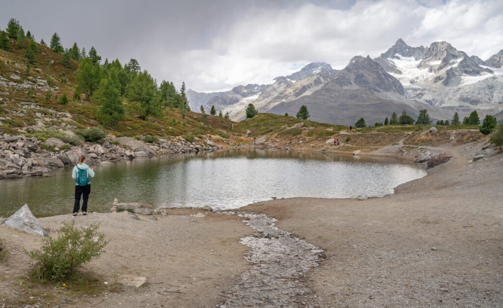
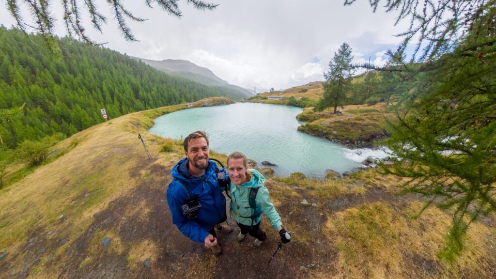
🪞 Stellisee Reflections
The most iconic of Zermatt’s five lakes, Stellisee delivers the classic postcard view of the Matterhorn reflected perfectly in still water – when weather cooperates. We arrived early, during the ideal 8:30-10 AM reflection window, and though clouds lingered, they parted just long enough for a brief, magical glimpse of the peak before closing in again. Surrounded by wildflowers and open alpine meadows, the lake feels peaceful and timeless, even when the mountain hides behind the mist. That fleeting reflection made the early start completely worth it – a reminder of how quickly beauty can appear and disappear in the high Alps.


Other Videos: TikTok
🔁 360 Photo
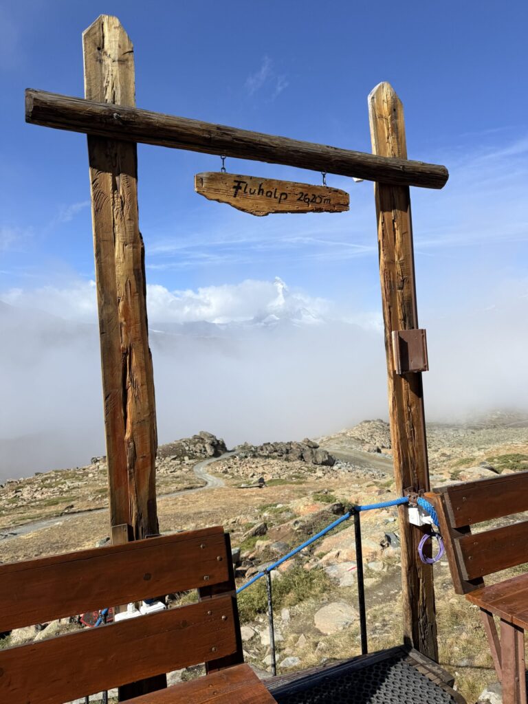
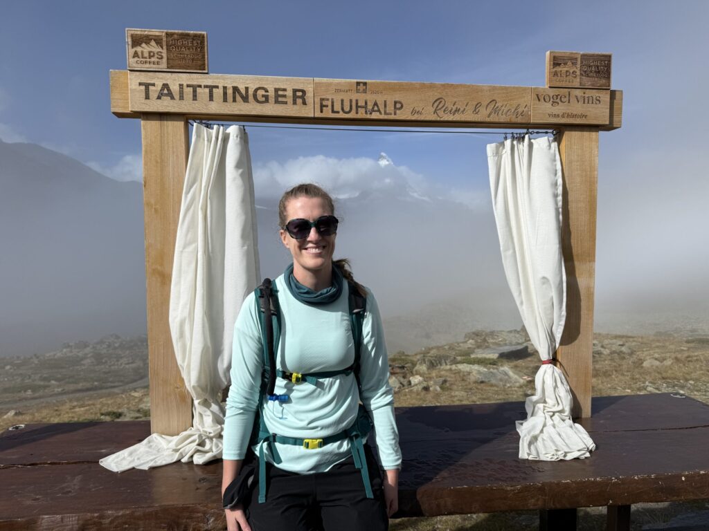
🏔️ Fluhalp
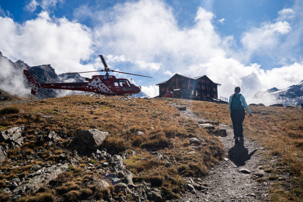
Perched high above Stellisee, Fluhalp is a cozy alpine hut that makes the uphill climb well worth the effort. The trail from Stellisee to Fluhalp is a steady ascent through rocky meadows, with the best Matterhorn views unfolding on the way back down toward the lake. When we arrived, we were lucky enough to watch a helicopter drop off supplies, an impressive sight against the rugged backdrop. We stopped to rest on the terrace, picked up a pair of much-needed sunglasses from the small shop, and snapped photos at the Fluhalp frame spots – even with the Matterhorn partly hidden by clouds, the scenery was spectacular. The descent offered sweeping alpine vistas with the Matterhorn dominating the sky and a dramatic wall of fog separating us from the Matterhorn, making Fluhalp a memorable and rewarding stop on the trail.


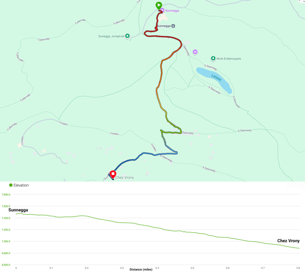
🛷 Mountain Carts: Blauherd → Sunnegga
From Blauherd to Sunnegga, the mountain cart ride was pure alpine Mario Kart – minus the banana peels but with every bit of the thrill. The gravel track twists through meadows and switchbacks framed by mountain views, giving you the perfect mix of speed and scenery. It’s a fast ~5 minute descent that’s absolutely unforgettable – proof that Zermatt isn’t just for hikers, but for anyone ready to feel like a kid again.
Other Content: Mario Kart on Insta360 X5 at 5X speed, Garmin Data
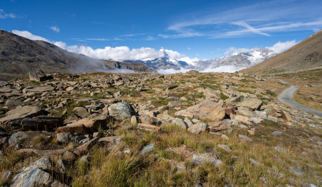
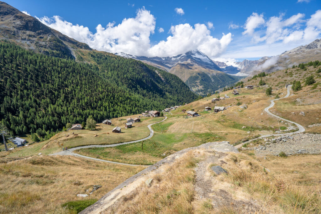
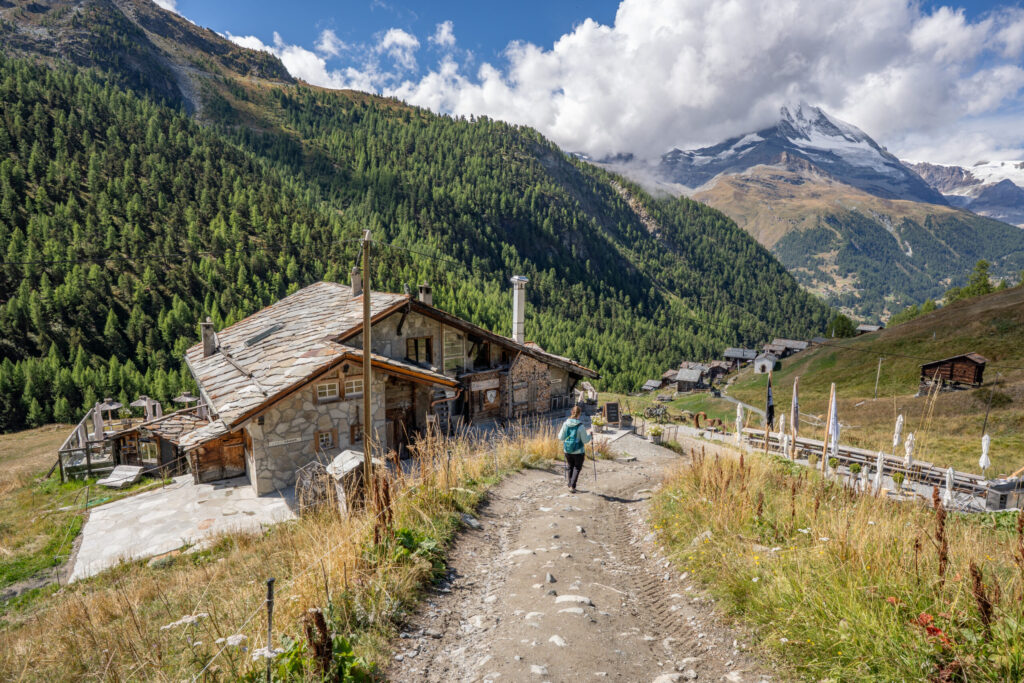
🧀 Gourmet Trail through Findeln
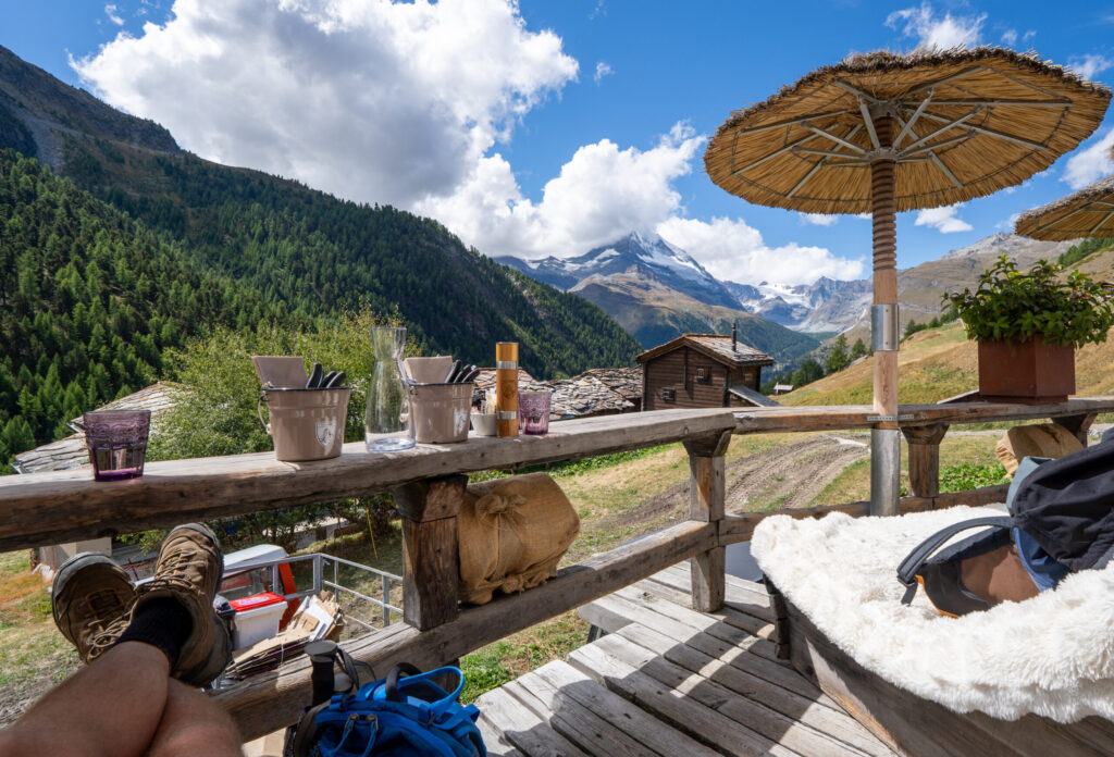
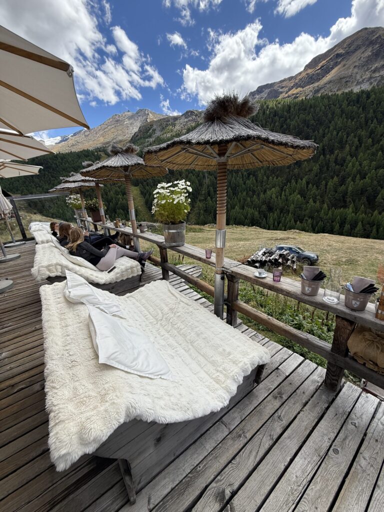
From Sunnegga, we set off on the Gourmet Trail, a steep but scenic downhill path that winds through alpine meadows and wooden chalets toward the charming hamlet of Findeln. The trail lives up to its name – a feast for both the eyes and the appetite – as it passes wildflowers, grazing sheep, and sweeping Matterhorn views that frame every turn. Nestled on a sunny slope below Sunnegga, Findeln is a storybook cluster of centuries-old chalets surrounded by fields scented with pine and mountain herbs. Cowbells echo softly through the valley, and the village is home to several of Zermatt’s most beloved mountain restaurants, including Chez Vrony, Findlerhof, and Adler Hitta. We continued down to Chez Vrony, the crown jewel of the Gourmet Trail, for a leisurely alpine lunch with panoramic views and cozy terrace loungers that made it hard to leave.
📈 Hiking Stats
Time: 18:35 moving, 28:30 elapsed to allow photo stops and confirm route
Distance: 0.8 miles (1.3 km)
Max Elevation: 7,479 ft
Cumulative Descent: 571 ft
Difficulty: Easy
Directions: From Sunnegga, follow the Gourmetweg signs downhill toward Findeln. The path begins as a gravel trail with multiple offshoots and a few steep sections that gradually open to sweeping views of the Matterhorn and the Findeln hamlet below. You pass rustic chalets and flower-dotted meadows along the way to reach Chez Vrony. For those wanting to continue the full Gourmet Trail, you can extend the route by visiting Adler Hitta, Findlerhof, and Enzian before looping back to Zermatt or taking the Sunnegga funicular back down to town.
Additional Resources: Garmin Data, AllTrails Full Gourmet Trail: Sunnegga – Zermatt
📸 Photos


🔁 360 Photos
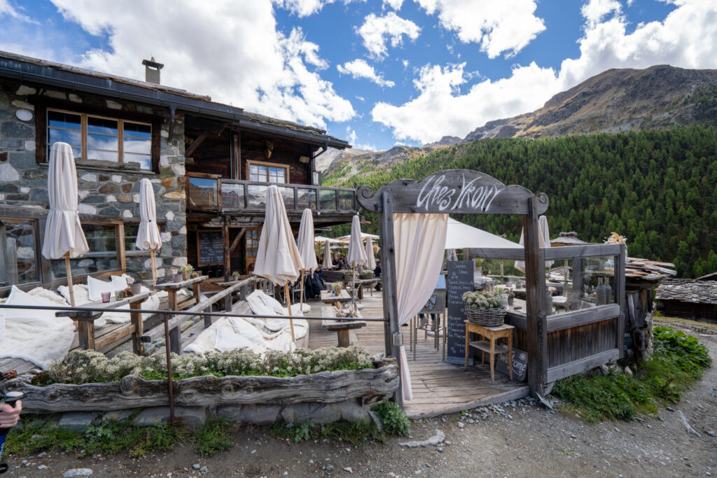
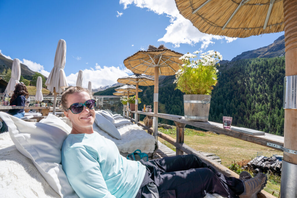
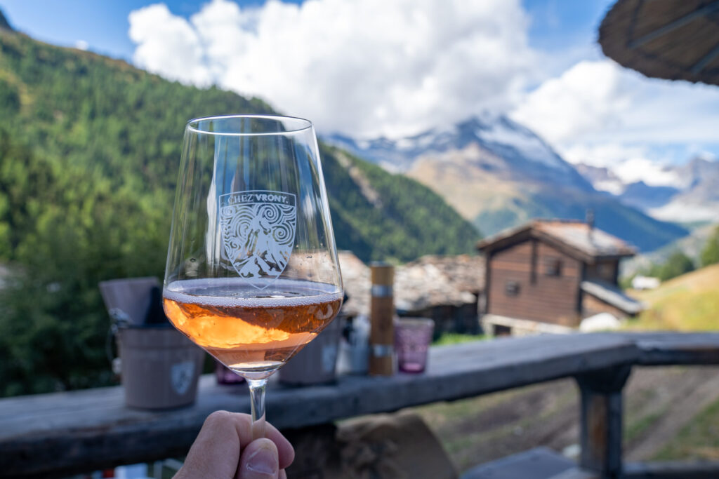
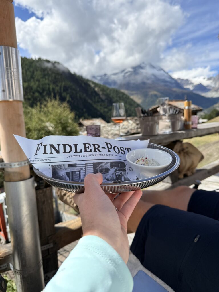
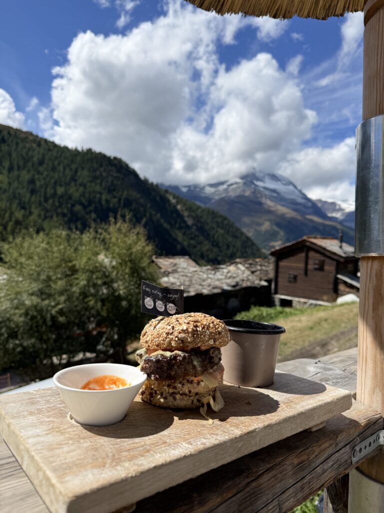
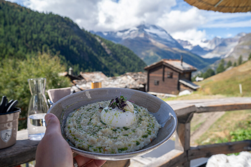
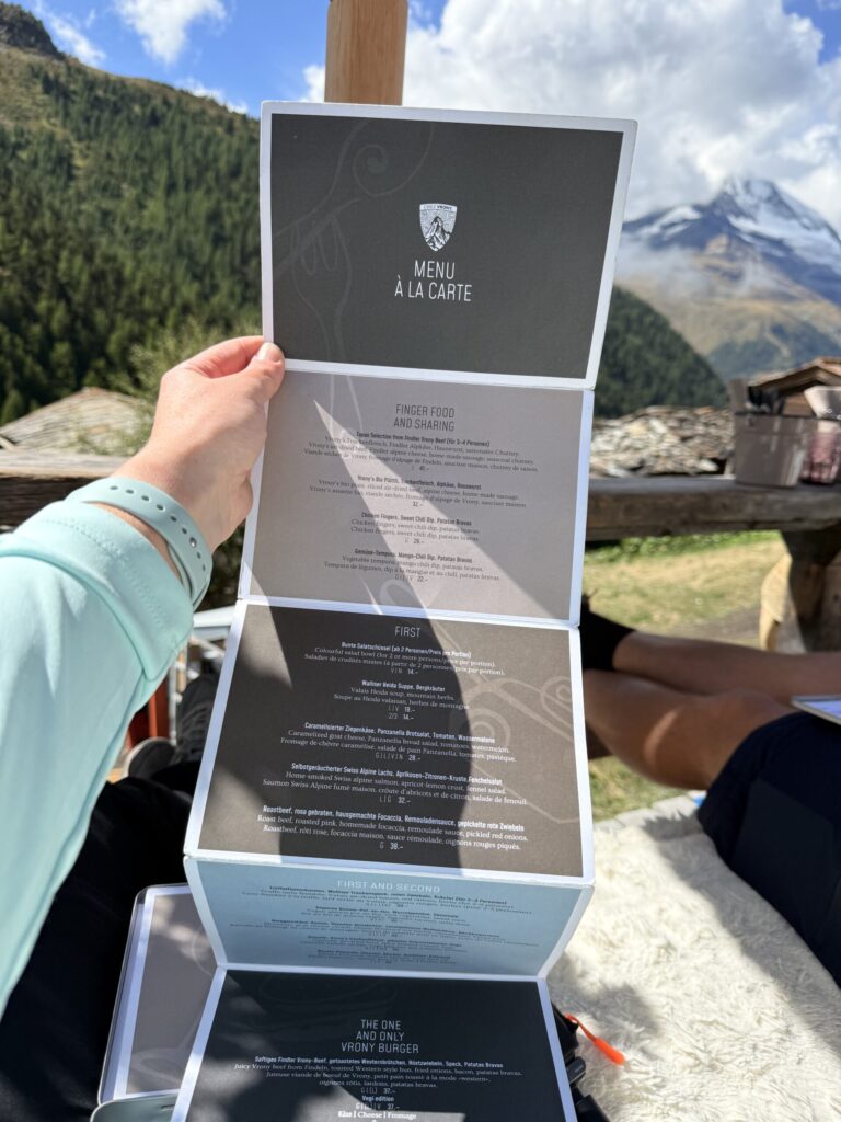
🍽️ Chez Vrony
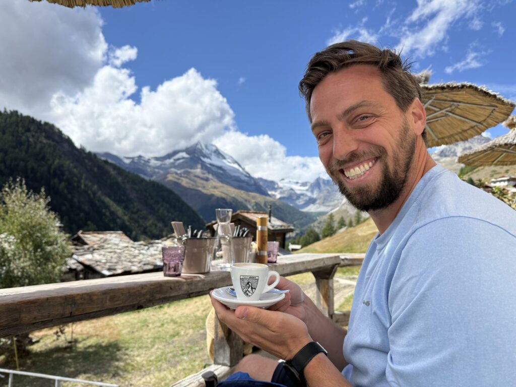
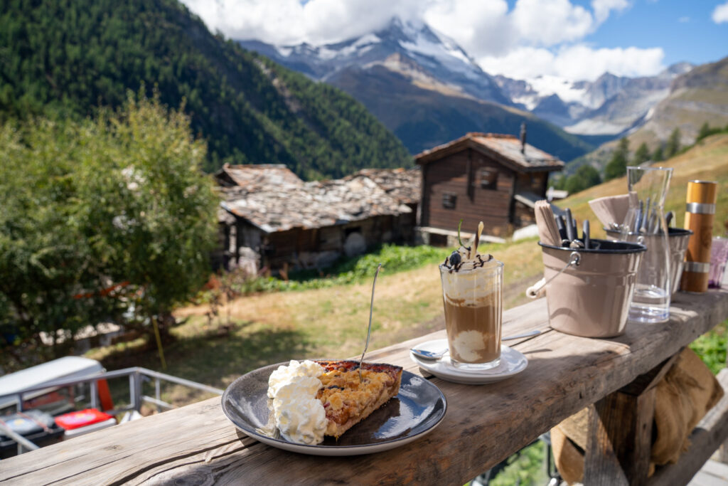
Perched above Findeln, Chez Vrony is one of Zermatt’s most celebrated Michelin-starred restaurants, effortlessly blending rustic chalet charm with refined alpine cuisine. We settled into fur-lined loveseats on the terrace, sipping a glass of rosé and savoring the complimentary Findler-Post appetizer while gazing at the Matterhorn drifting in and out of the clouds. For the main course, I ordered the “One and Only Vrony Burger,” which looked stunning but didn’t quite live up to its reputation – the “Western-style” bun was a bit dry and heavy on seeds, muting the flavor of the local Findeln beef. Scott’s Risotto Piemonte with lemon, burrata, and basil-herb oil was the clear standout – creamy and beautifully balanced. We finished with Martina’s Früchtekuchen (fruit tart), a decadent Gletscherkaffee (a mix of Glacier coffee, vanilla ice cream, Kirsch, Baileys, and espresso), and a final espresso, soaking in the cozy mountain ambiance as the clouds rolled past. Even with a few culinary misses, the experience was pure alpine perfection – making Chez Vrony an unforgettable and must-visit stop along the Gourmet Trail.


🔁 360 Photo
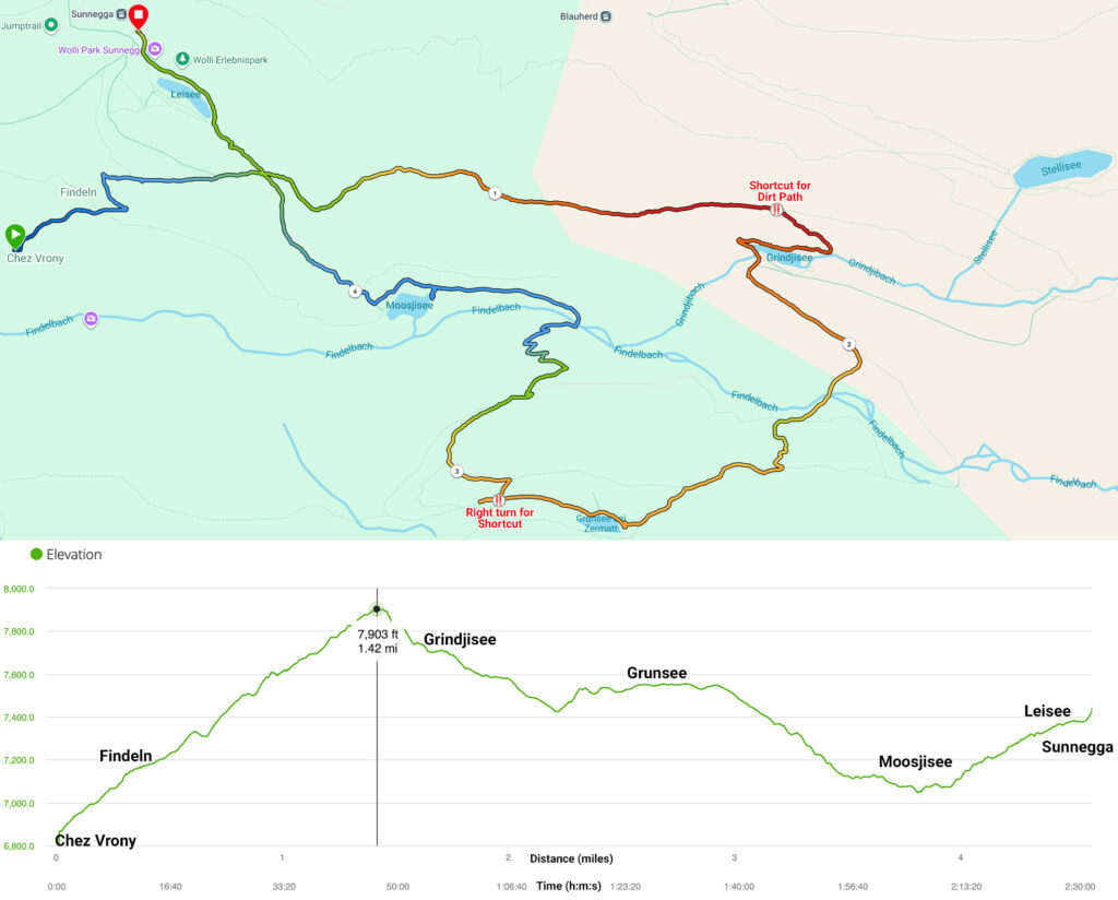
🌊 Partial 5-Lakes Trail
After lunch, we continued along a partial route of the 5-Lakes Trail from Findeln, visiting the four lakes we hadn’t yet seen – Grindjisee, Grünsee, Moosjisee, and Leisee. We opted for this variation to avoid backtracking to Stellisee, which we’d already experienced that morning during the ideal reflection window. This alternate route began with a steeper uphill climb before merging with the main 5-Lakes path. It was a worthwhile trade-off for the earlier Matterhorn views because clouds had completely taken over by this point, hiding the Matterhorn for the rest of the hike.
By the time we reached the final lakes, light rain had begun to fall, and the once-reflective surfaces grew dull and flat – beautiful in their own quiet, moody way, but with no hint of the Matterhorn that had disappeared behind the clouds.
Other Videos: YouTube Short
📈 Hiking Stats
Time: 1:37 moving, 2:32 elapsed to allow photo and rest stops
Distance: 4.6 miles (7.4 km)
Max Elevation: 7,903 ft
Cumulative Ascent: 1,585 ft
Cumulative Descent: 1,022 ft
Difficulty: Easy to Moderate
Directions: From Chez Vrony, follow the short uphill dirt and gravel path (~10m, 0.3 mi) to Findeln, then continue on the 5-Seenweg (5-Lakes Trail) toward Grindjisee. This stretch (~50m 1.3 mi) climbs steeply before descending along a dirt path shortcut (‼️ not very visible from the main trail) to the tranquil, green-tinted lake. If you miss the shortcut at ~1.5 miles, you’ll likely add on a around mile to hike the outer loop from the Stellisee 5-Seenweg connection. Continue uphill (~30m, 1 mi) to Grünsee, where rocky shores and mountain reflections create a perfect photo stop.
Shortly after Grünsee (~0.1 mi at the 2.8 mi mark), watch for a right turn that leads to a scenic shortcut through the woods with gnarled, twisty trees. Continue descent (~30m, 1.2 mi) toward Moosjisee, a striking turquoise glacial lake with views of the hydroelectric dam. The final climb to Leisee is steep ascent (~30m, 0.6 mi), rewarding you with family-friendly picnic spots and more Matterhorn vistas. When finished, take the free lift from Leisee up to Sunnegga to complete the loop and head back toward Zermatt.
Additional Resources: Garmin Data, Komoot route, AllTrails
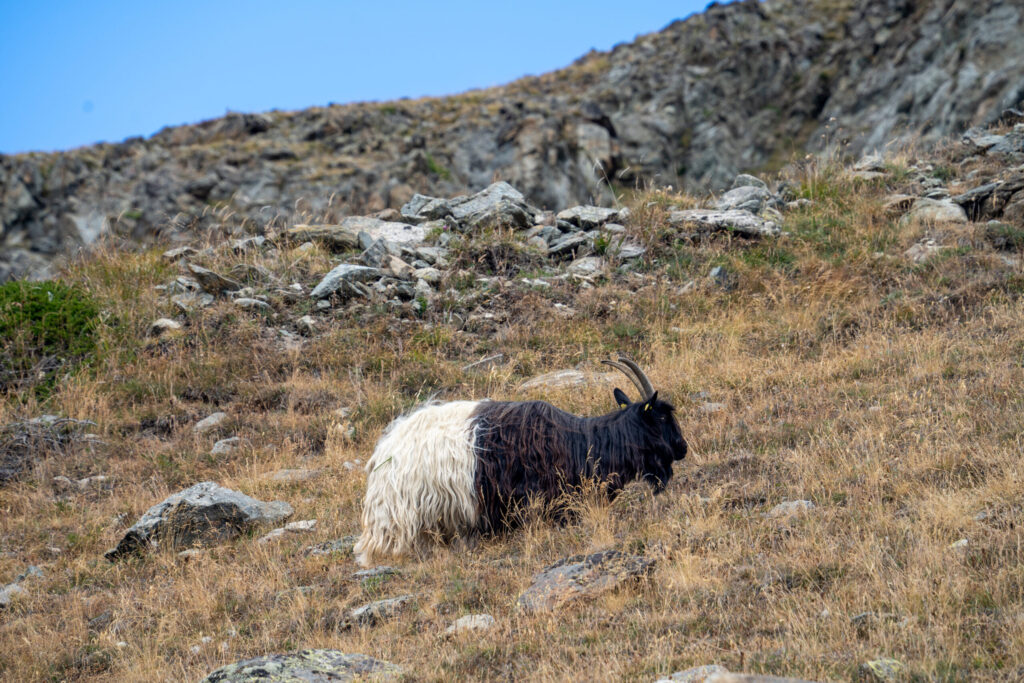
🐐 Valais Blackneck Goats
On the steep ascent from Findeln, the climb was tough, but the reward came in the form of a surprise encounter with a herd of Valais Blackneck goats. Their striking black-and-white coats stood out brilliantly against the slopes, creating a picture-perfect alpine moment. These goats are native to the region and almost look too beautiful to be real, with long, silky hair and gentle expressions that seem to belong in a fairytale. Watching them graze and wander freely across the hillside made the steep stretch entirely worth it and added a dose of Swiss mountain charm to the Five Lakes Trail.


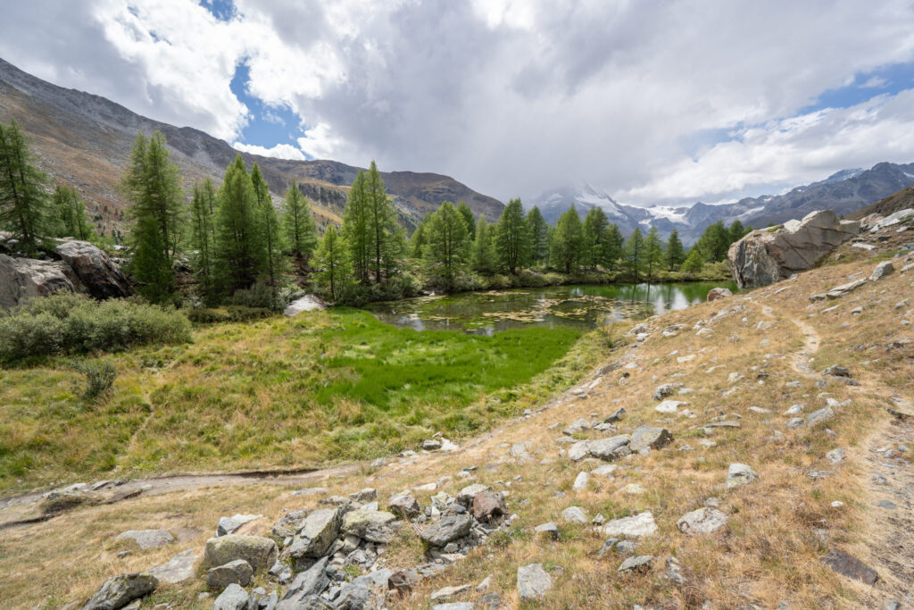
🌲 Grindjisee
Tucked in a forest clearing, Grindjisee is a peaceful green lake framed by larch trees and bursts of wildflowers. The Matterhorn typically peeks through the trees but was covered by clouds during our visit. It’s a lovely spot to pause and soak in the stillness.

🔁 360 Photo
Grünsee
Grünsee typically shimmers in shades of deep green and turquoise, though on our visit it carried a moody, overcast glow beneath gray skies. The rocky landscape surrounding it felt rugged and raw, giving the lake a wild, untamed character. Behind the shore, a silver water conduit—part of Zermatt’s old mountain irrigation system known as a “Suone” or bisse—trickled steadily through the rocks, adding a rhythmic soundtrack to the misty calm. Even without reflections, Grünsee’s quiet beauty, combined with this otherworldly woodland, made it a memorable section of the hike.


🔁 360 Photo
As we continued along the trail, we entered a stretch of gnarled, twisty trees that looked straight out of Fangorn Forest, their mossy trunks curling in every direction.


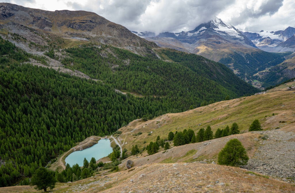
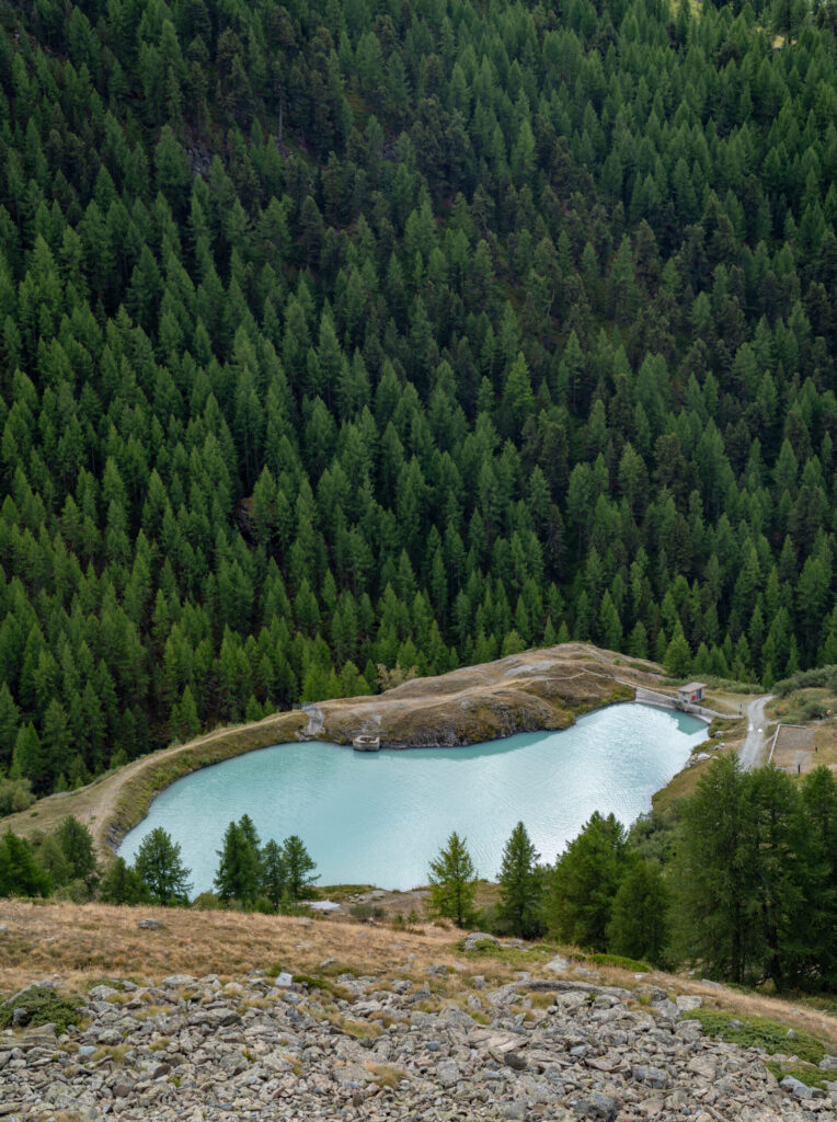
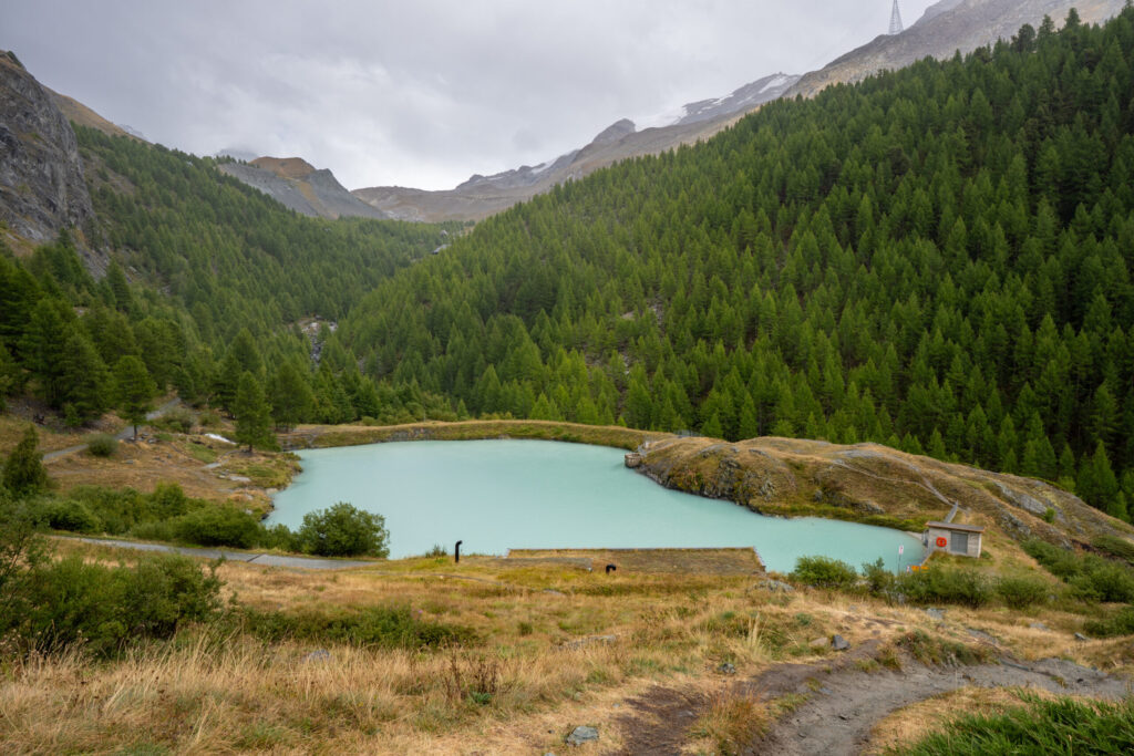
🧊 Moosjisee
Fed by glacial runoff, Moosjisee glows in brilliant turquoise tones that shift with the light. Overlooked by a small hydroelectric dam, the lake feels more rugged and industrial than the others, yet its color is mesmerizing – especially on overcast days when it seems to glow from within.


🔁 360 Photo
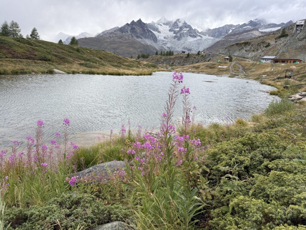
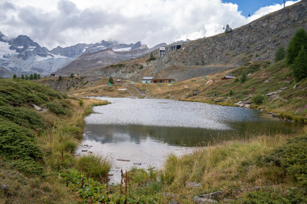
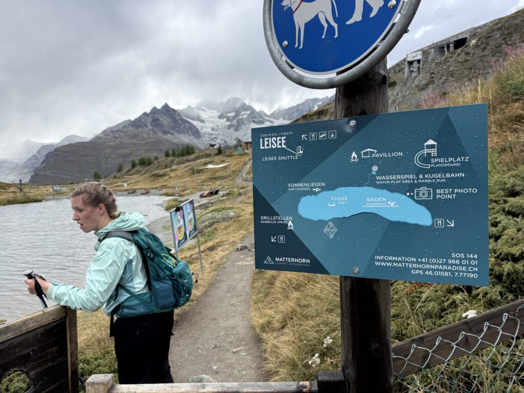
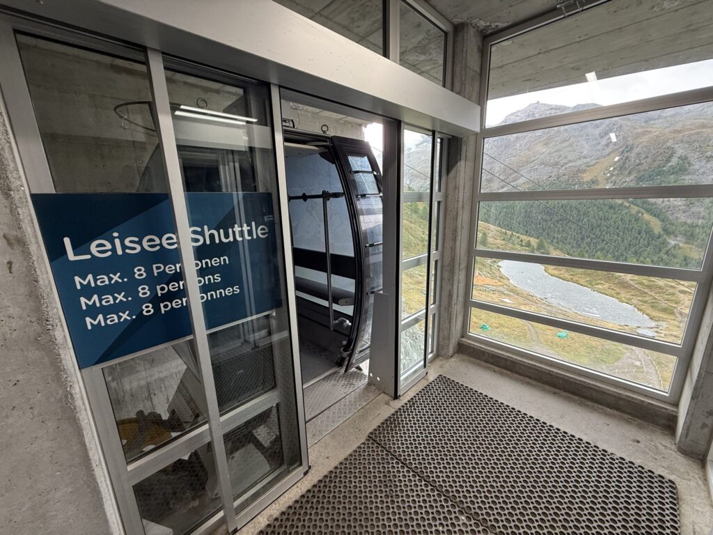
🏊♂️ Leisee
The final lake is Leisee, a peaceful, family-friendly lake surrounded by picnic areas and playgrounds , making it a lively contrast to the wilder alpine lakes higher up. This is the only lake along the trail where swimming is allowed, and on sunny days is likely popular for hikers to finish with a dip. On clear days, the Matterhorn reflects across its calm surface, though when we arrived, clouds and drizzle softened the scene into a quiet, misty finish. Even without the views, it was a relaxing place to pause before taking the free lift back up to Sunnegga.

🔁 360 Photo
🛴 Kickbike: Sunnegga → Zermatt
To end the day, we swapped hiking boots for kickbikes, gliding from Sunnegga back to Zermatt along a mostly forested path with limited views but plenty of charm. The route alternated between short downhills and one surprisingly long flat stretch that had us kicking hard and questioning whether we’d somehow missed a turn. (Spoiler: we hadn’t – see our Garmin route below.) Despite the drizzle and muddy sections, the pine-scented air made it a fun, quirky way to wrap up a long, adventure-filled day in Zermatt.
📈 Kickbike Stats
Time: 30:39 moving, 40:13 elapsed for stops to confirm directions
Distance: 4.6 miles (7.5 km)
Max Elevation: 7,509 ft
Cumulative Descent: 2,367 ft
Directions: From Sunnegga, follow the signs for Kickbike Route to Zermatt, which begins near the mountain station’s rental stand. You’ll roll onto a gravel and forested trail that winds steadily downhill toward the valley. The path alternates between shaded stretches and open clearings, with one long flat section midway that requires a good amount of kicking to keep momentum (it’s easy to think you’ve gone off course here, but you haven’t – see our Garmin route below for reference). There are a few other spots that were a bit confusing, which we point out in our video above. Also there’s one treacherous manhole that we almost hit that could send you plummeting off the side – be sure to stay towards the middle of the route when you approach the paved section towards the end. The ride ends near the Sunnegga funicular base station in Zermatt, where you’ll return your kickbike via an elevator. The return station closes at 5:30 PM – the latest they’ll rent bikes is 4:30 PM to allow plenty of time for the return.
Additional Resources: Garmin Data
🗺️ Kickbike Route
🏔️ Original Rothorn Plan
Our original plan was to start at the Rothorn summit and hike down to Blauherd, a route known for its sweeping Matterhorn panoramas and endless wildflower meadows. Unfortunately, the Rothorn cable car was closed due to a rockslide, blocking access to the upper station. Hiking up from Blauherd instead would have meant a long, steep climb with limited time before our lunch reservation at Chez Vrony, so we opted to explore the lower section of the trail instead. This ended up being a great compromise – still filled with alpine beauty, colorful blooms, and stellar views –without the exhausting uphill push or the risk of running short on time. Below was our original itinerary for this visit to Rothorn.
- 🚠 8:20 AM – Cable Car: Blauherd → Rothorn (7m, every 10m at xx:00/:10/:20/:30 from 8:20 AM – 4:40 PM) ⚠️🪨 Closed due to a rock slide during our visit
- 🥾 8:45 AM – Hike: Rothorn → Blauherd (~2h, 3.3 mi downhill)
- 🌸 Matterhorn views, wildflowers, and alpine scenery
- 🌊 Stop at Stellisee Lake for iconic Matterhorn reflection (~30m, 2.4 mi)


2 Comments
[…] 🛴 Kickbike: Sunnegga → Zermatt […]
[…] Blauherd to Sunnegga: Crystal Trail to Stellisee + 5-Lakes Trail + Mountain Carts + Gourmet Trail to Chez Vrony (Aug […]